
Clint Zimmerman
Water Superintendent, Norwood, OH
"The software is incredibly easy to use... One of the best features for me is that I can take pictures in the field from my tablet or phone and upload that to a work order."

![]()
ArcGIS Integration
Our seamless two-way integration with Esri allows you to automatically pull data and layers into iamGIS.
![]()
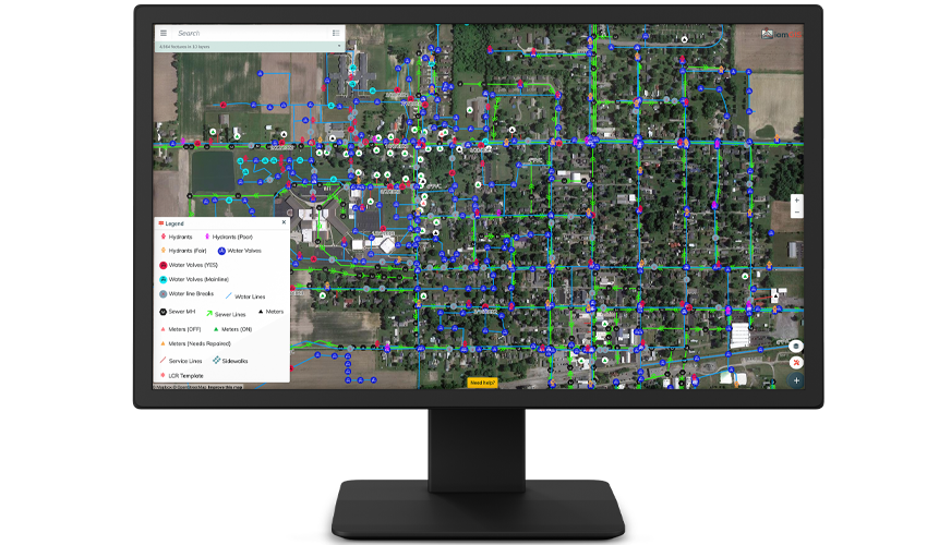
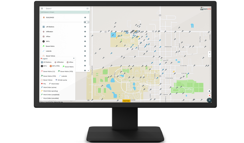
GIS Mapping
Create and update interactive maps. iamGIS is 100% compatible with Trimble and other GPS devices.
![]()
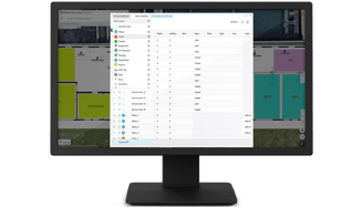
Asset Management
Easily track and manage your city's assets in real-time with unlimited data and media storage.
![]()
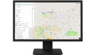
Work Orders
Create, track and manage the daily tasks and report on all data you need to run your operations.
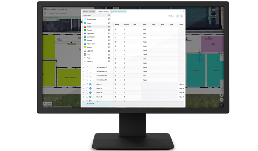
We’ve made asset and facilities management so simple it can be done in seconds, updated in real-time. Gain full visibility and control over your assets to quickly track, manage, and optimize your infrastructure. There are no data limits or constraints; upload unlimited data including images, videos, documents, and more.
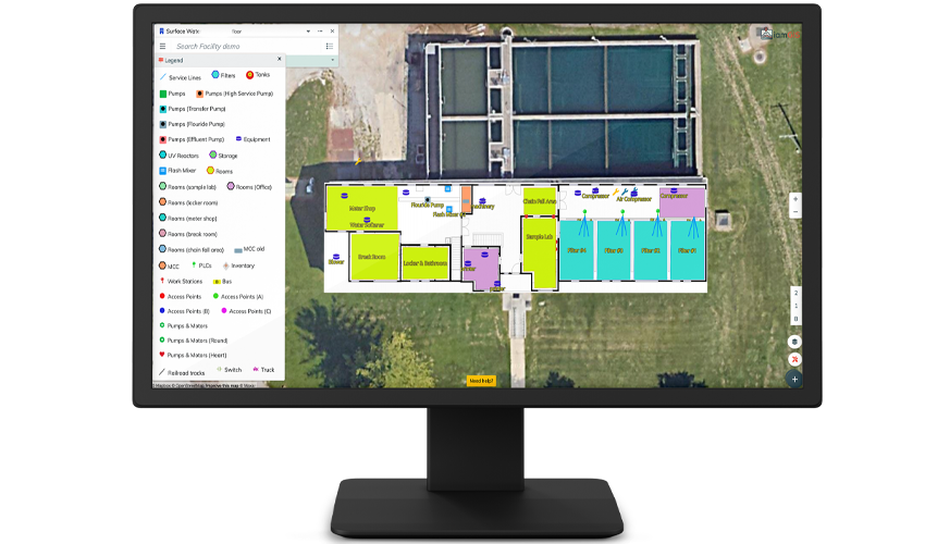
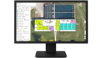
Keep your buildings up-to-date, and up-to-code with real-time updates, work orders, and asset tracking. See your buildings and their floorplans in 2D or 3D. Attach any kind of media to your structures so you can always have visibility and control.
Stay on top of your operations with one-click work orders and task management. Attach work orders and tasks to specific assets and streamline communication with automatic email and text notifications. Quickly report on open, assigned and completed tasks across your organization.
We’ve made asset and facilities management so simple it can be done in seconds, updated in real-time. Gain full visibility and control over your assets to quickly track, manage, and optimize your infrastructure. There are no data limits or constraints; upload unlimited data including images, videos, documents, and more.
Keep your buildings up-to-date, and up-to-code with real-time updates, work orders, and asset tracking. See your buildings and their floorplans in 2D or 3D. Attach any kind of media to your structures so you can always have visibility and control.
Stay on top of your operations with one-click work orders and task management. Attach work orders and tasks to specific assets and streamline communication with automatic email and text notifications. Quickly report on open, assigned and completed tasks across your organization.
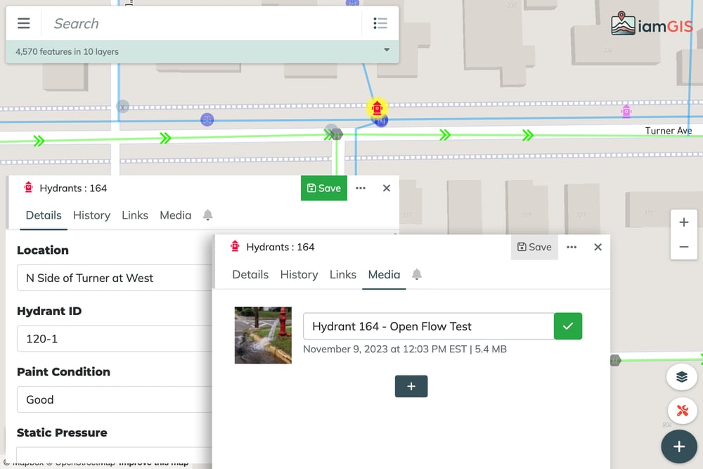
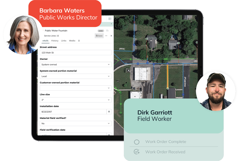
With our mapping and asset management capabilities, public works departments can digitally track and manage a wide range of infrastructure assets, including roads, bridges, fire hydrants, water lines, manholes and more.
.webp?width=800&height=502&name=facilityoverlay%20(1).webp)
Capture 2D and 4K 3D models of any facility. Digitize your blueprints and floorplans in 2D or 3D scan your facilities to create a powerful digital twin.
Add additional levels of floor plan and enrich asset data by attaching photos, videos, and standard operating procedure guides to each asset.
3D models seamlessly integrate with iamGIS empowering you to manage assets and track work orders.
%20(1).png?width=1000&height=667&name=demo.iamgis.net_map_6(Surface%20Pro%207)%20(1).png)
Keep tabs across all your Special District assets with visual mapping and custom fields. Whether you're a Water District, Park District, Fire District or any other type of Special District, use iamGIS to track and maintain all assets and data for preventative maintenance, inspections, and repairs.
Easy asset management is at your fingertips from any mobile device.
"The software is incredibly easy to use... One of the best features for me is that I can take pictures in the field from my tablet or phone and upload that to a work order."
"Being out in the community, I can pull up iamGIS on my tablet and show anyone our water lines, valves, hydrants- our entire system. They can see where their tax dollars are going and the cost savings at work."